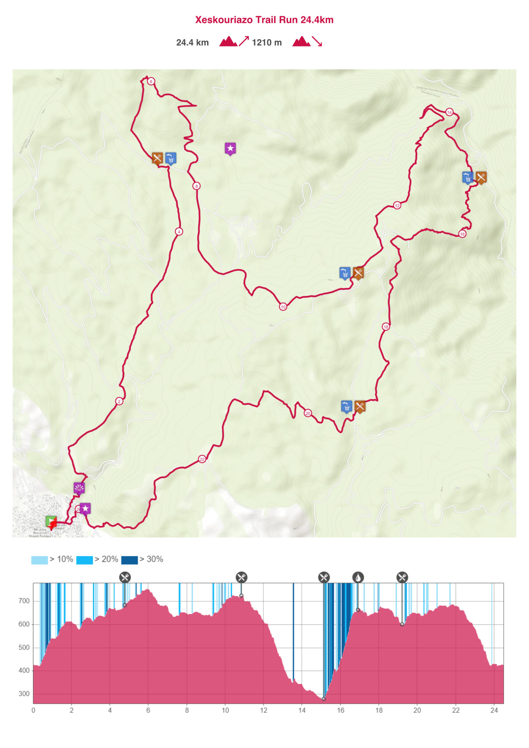
Technical Description – 24km
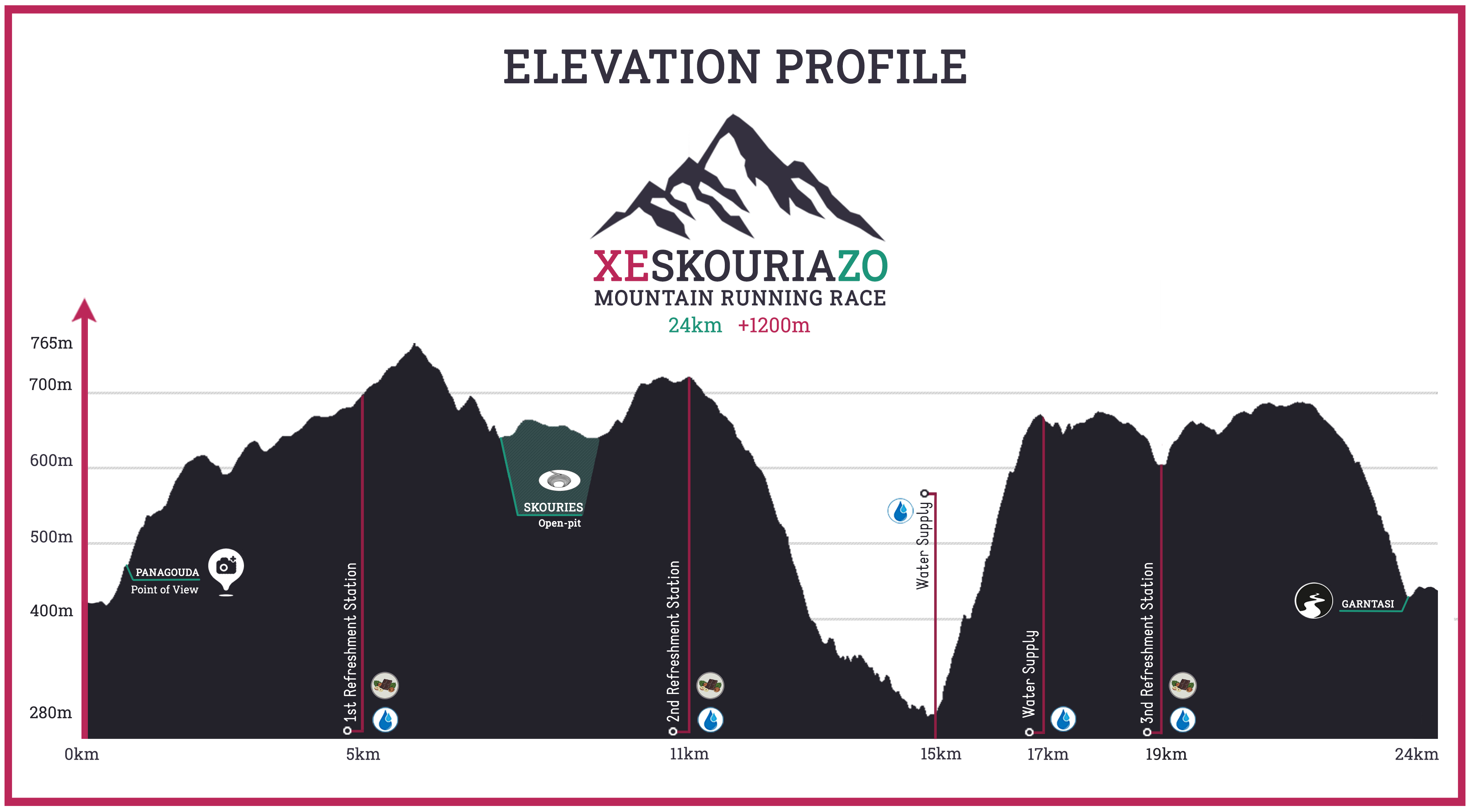
The race starts from the village of Megali Panagia, with both the starting point and the finish line at the village square (Chorostasi) at an altitude of 430m. Passing through the village streets and narrow alleys, it ascends towards the Church of “Panagouda” at an altitude of 480m, a location with a magnificent view over the village. Here, the houses of the village end, and we follow a forest road for 900m until reaching the location of Lakoudia at an altitude of 560m. Having covered the first 1.5 kilometers of the route, it is time for athletes to leave the road and start crossing part of the trail network of Mountain Kakavos.
For the next approximately 3.5km, the route moves along an uphill trail until reaching the first refreshment station at 5.0km and an altitude of 700m. This is followed by 600m of forest road and another 60m of elevation gain (760m) until we re-enter a trail and start descending for 1.3km to an altitude of 670m through a beautiful forest towards the location of Skouries, witnessing the open pit and the destruction that the Kakavos forest has suffered.At this point, athletes emerge onto a dirt road, which they follow for about 700m. They continue for approximately 2km (500m of asphalt road and 1.5km of gravel/dirt road) until they re-enter a trail through oaks for 1.2km. . After exiting the trail, the second refreshment station is just a few meters away. The total distance covered up to this point is about 11km, with an elevation of 730m.
Shortly after the station, the route begins a steep descent through a trail until reaching the lowest point of the race at 280m. To reach this point, athletes need to cover another 4km.
The total distance covered up to this point is 15km, and at this location, the third refreshment station is located.
From this point on, the route begins the section with the most intense incline, as athletes need to ascend from 280m to 680m (+400m) within 1.8km of trail, where a support station is located.
Continuing the route, just before reaching 18km, we encounter a forest road, which we use for approximately 270 meters until the next 1.2km trail that descends rapidly to 610m, where the fourth and final refreshment station is located. Immediately after, the last ascent begins, taking us to approximately 700m elevation.
Having covered slightly over 21km and being at an altitude of 690m, we come out onto a forest road that descends towards the village. We follow it for about 1km until we enter the last 2km trail, characterized by a steep descent, leading us into the village at an altitude of 430 meters. The landscape changes from this point onwards. The dense forest gives way to sparser vegetation and small meadows. This trail is different from what we have encountered so far. It is narrower compared to the previous ones and has rocky sections, making it more technical. After the end of the trail, we enter the first houses of the village, and the finish line is just a few hundred meters away.
Download the GPX file of the route