Technical Description – 14km
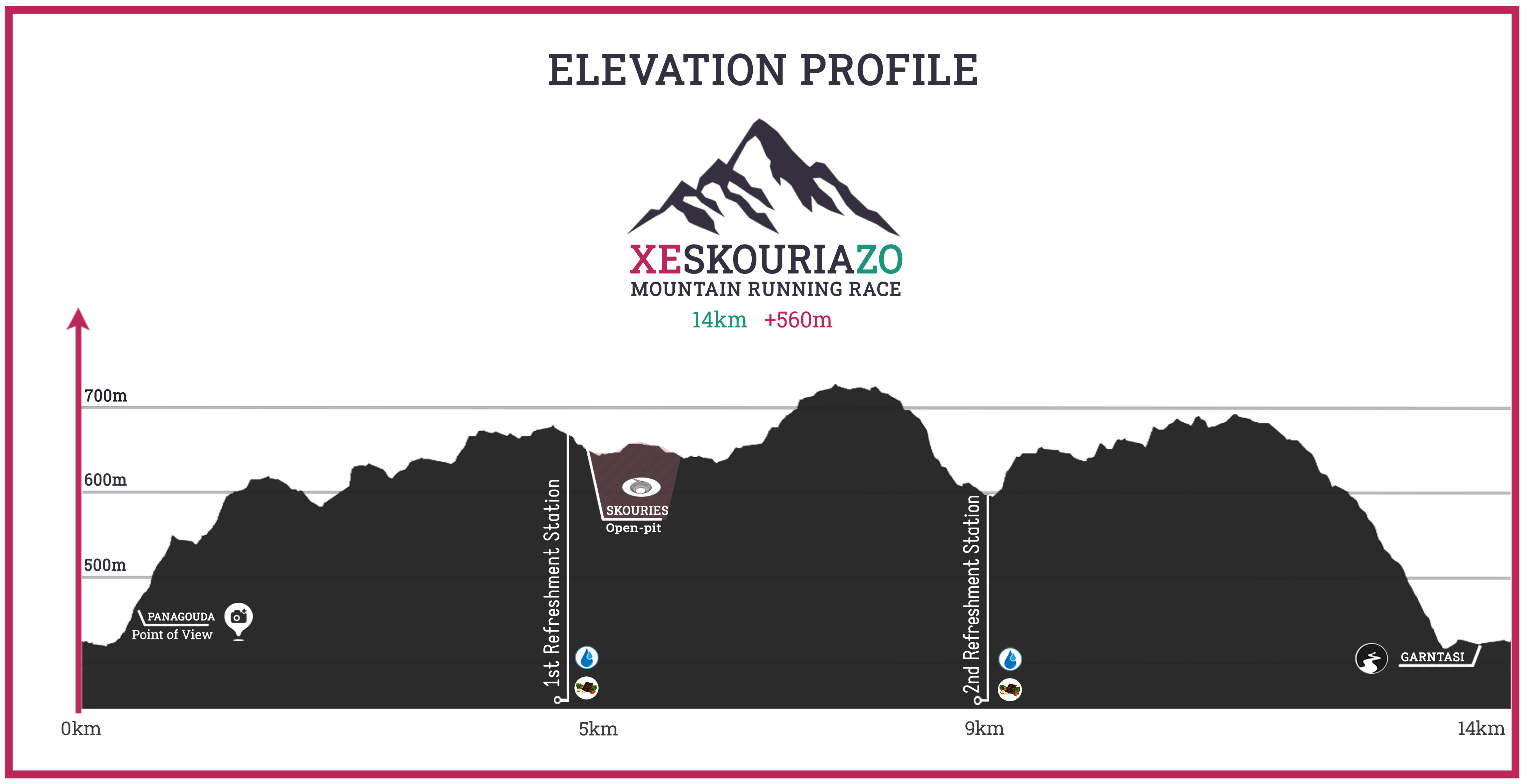
The race starts from the village of Megali Panagia, with both the starting point and the finish line at the village square (Chorostasi) at an altitude of 430m. Passing through the streets and narrow alleys of the village, it ascends towards the Church of Panagouda at an altitude of 480m, a location with a magnificent view over the village. Here, the village houses end, and we follow a forest road for 900m until reaching the Lakoudia location at an altitude of 560m. Having covered the first 1.5 kilometers of the route, it is time for athletes to leave the road and start crossing part of the trail network of Mountain Kakavos.
For the next approximately 3.5km, the route moves along an uphill trail until reaching the first refreshment station at 5.0 km and an altitude of 700m. We continue to the right on a 250m asphalt road and a 1.5km gravel/dirt road next to the Open_Pit in the Skouries location until we re-enter a trail through oaks for 1.2km. Exiting the trail, a few meters away, we encounter a refreshment station that serves the 24km race.
Shortly, following the road to the right for 200 meters and at an altitude of 720m, we enter a downhill trail of approximately 1km in length. The trail meets a forest road, which we follow for a few meters until we reach the second refreshment station at an altitude of 610m. Immediately, the last ascent begins, taking us to approximately 700m elevation.
Having covered slightly over 11.5km, we come out onto a forest road that descends towards the village. We follow it for about 1km until we enter the last 2km trail, characterized by a steep descent, leading us into the village at an altitude of 430 meters. The landscape changes from this point onwards. The dense forest gives way to sparser vegetation and small meadows. This trail is different from what we have encountered so far. It is narrower compared to the previous ones and has rocky sections, making it more technical. After the end of the trail, we enter the first houses of the village, and the finish line is just a few hundred meters away.